Saturday, October 8, 2011

State Line North Hike 2011

We drove to the town of Superior, about 70 miles west of Missoula with our friends Marybeth and Bolton and hiked the State Line North Trail, which is the trail that literally follows the state line between Montana and Idaho.
Trail head

Parking lot at beginning

Bolt, MB and Paula heading up the ridge.

The ridge ahead of us.
MB and Paula


Blown ice on the trees.

MB and Bolton
Fresh Bear tracks in the snow.
Two Ptarmigans
The trail is on the right hand side

Paula on the ridge
Bolt and MB
Paula, Bolt and MB


Looks like Everest. (Paula in forground, Bolt & MB in distance)
On the way back down.
Bolt on the decent.
Paula
MB and Paula

MB on Illinois Peak
Lunch on Illionis Peak

Monday, September 26, 2011

Glacier National Park 2011

This past weekend we went hiking with our friends Marybeth and Bolton in Many Glacier (Northeast side of Glacier National Park).
We stayed in cabins at Swiftcurrent and did a 15 mile hike up to Ptarmigan tunnel and then a side trip to Iceberg lake on the way back.  We came within 30 feet of a bear on the trial and luckily no one was eaten.
Bolt and Jim
View up the valley
Paula

Ptarmigan Lake

Switchbacks up to the Ptarmigan Tunnel (Paula & MB in foreground)


Looking back on the switchbacks.
Looking straight down, very steep.
Tunnel is at end of last switchback.
Bolt at tunnel door.

Going through the tunnel.

On the other side, beautiful Argillite rocks. (*Argillite is the term used by geologists for a rock, originally a shale, which has been recrystalized or made harder by greater pressure. In external appearance it looks like shale.


Self Portrait
MB and Paula


Close up of rock strata


Bolt and MB 
On the way back down.

Looking back out the valley
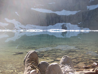
Iceberg lake

Jim and Paula in Iceberg lake (yes, the water was really, really cold)


Paula (white dot in shadow is a mountain goat)
Heading back to Swiftcurrent


Almost home again.